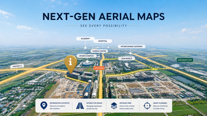
Transforming 360 Drone Aerials Into Interactive Real Estate Maps - PanoCool Feature Showcase
In the competitive world of property marketing, static imagery and traditional drone videos no longer cut it. When buyers look at a massive real estate development, standard 2D formats fail to convey the true scale, surrounding context, and real-world infrastructure.
To bridge this gap, modern developers and marketers are